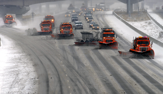
SALT LAKE CITY, Utah Feb. 7, 2019 (Gephardt Daily) — The prolonged winter storm that spelled chaos for scores of Utah drivers, and resulted in a day off for thousands of school kids Wednesday, could generate even more headaches during the Thursday morning commute.
According to the National Weather Service in Salt Lake City, heavy bands of lake effect snow are expected to dump another 4 plus inches across the Salt Lake Valley floor by mid morning, with totals considerably higher on the benches and in the mountains.
The Utah Department of Transportation posted a statement on social media Wednesday night saying, “Lake enhanced snow showers have organized and will be moving through the Salt Lake Valley through this evening. This will likely affect the PM commute with additional road snow impacts ranging from just south of Farmington to West Valley.”
A good portion of the Wasatch Front will also be affected, with steady snowfall expected along the I-15 corridor from just north of Spanish Fork to south central Davis County.
Wednesday, Utah Highway Patrol officers responded to more that 400 accidents, the vast majority of them in Salt Lake and Davis Counties.
Dozens of local schools, including the Salt Lake City District Schools and University of Utah, were forced to close Wednesday.


