

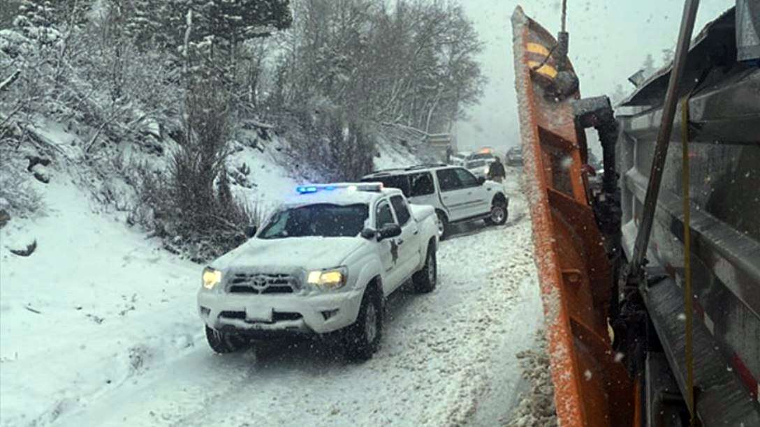
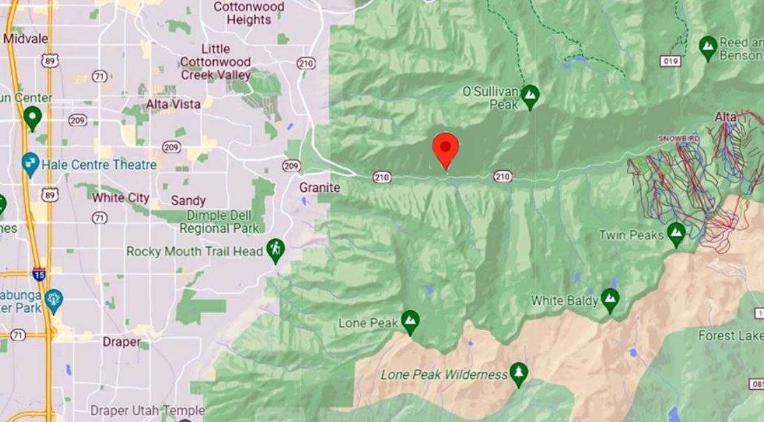
SALT LAKE COUNTY, Utah, March 20, 2022 (Gephardt Daily) — Unified Police and Fire Authorities responded to the scene of a multi-vehicle crash up Little Cottonwood Canyon, at White Pine Chutes, near mile marker 8 of State Route 210.
“SR-210 travelers! There is a multi-vehicle crash at White Pine Chutes,” says a Twitter post issued at 12:44 p.m. Sunday by UDOT.
“@updsl, @altacentral, @unifiedfire are on the scene & may hold traffic intermittently to clear. Please use caution in the area & expect delays, roads are SLICK.”
The UDOT traffic site shows the incidents have been cleared as of later Sunday afternoon.
A Winter Weather Advisory remains in effect through early evening in much of northern Utah.

Forecast
Logan has a chance of snow through this evening, according to the National Weather Service, and could drop to 10 degrees overnight, with a wind chill making the temperature feel like zero degrees Fahrenheit. Skies should be clear and sunny on Monday, followed by a high of 32 degrees and a low of 16 degrees.
Ogden saw snow late Sunday morning, but is likely done for the day. Sunday’s low will be around 14 degrees, with mostly sunny skis Monday and highs near 40 and a low at about 14 degrees.
Salt Lake City has a 50 percent chance of snow into Sunday afternoon, according to the National Weather Service. Monday will be mostly sunny, with a high of about 34 degrees and a low at about 24.
Park City should reach a low of 8 degrees, th
e NWS says. Monday has a predicted high of 27 degrees and a low of 13, with sunny skies until a few clouds appear in the evening. But wind chill could make it feel like -7 degrees during the day, and -1 at night, the NWS site says.
Provo gets a few more degrees of warmth, with a low of 27 Sunday night, but a balmy 46 degrees high on Monday, with a Monday low of 29.
The south half of Utah is was not expected to get as much snow, but parts are under a high wind warning Sunday, expected to continue for a few days.
Price was expected to get some snow Sunday, and remains under a high
wind warning expected to continue through about 6 a.m. Monday, the NWS site says. Gusts on Sunday could reach 44 mph, with a drop to a 37 mph high predicted for Monday.
And St. George was expected to get wind gusts up to 43 mph Sunday night.
To see the forecast or get additional details for your own city, visit the NWS Utah website, check out the map, and click on your city or one close to your own.

