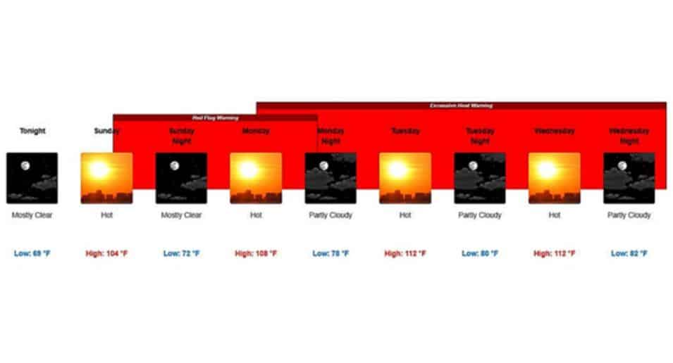
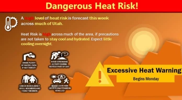
UTAH, June 12, 2021 (Gephardt Daily) — The National Weather Service, Salt Lake City Office, has issued a dangerous heat warning, to last for multiple days beginning Monday.
“A high level of heat risk is forecast this week across much of Utah,” says a statement issued by the agency. “Heat risk is high across much of the area if precautions are not taken to stay cool and hydrated. Expect little cooling overnight.”
The National Weather Service suggests taking the following basic safety precautions:
- Drink before you are thirsty
- Reduce time in the sun
- Avoid strenuous activity; postpone outdoor afternoon activities
- Seek air-conditioned buildings
- Check on elderly and neighbors
- Help kids and pets stay cool
- Close blinds during the day
- Call 911 in case of emergency
All graphics below are from the National Weather Service.
The map below shows statewide conditions as of 5:06 p.m. Saturday. For updated information and to use interactive features, click the National Weather Service link, here.
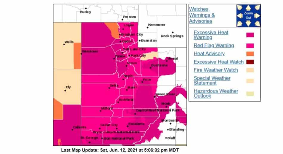
To see local forecasts, check below. Locations are are listed north to south.
● ● ●
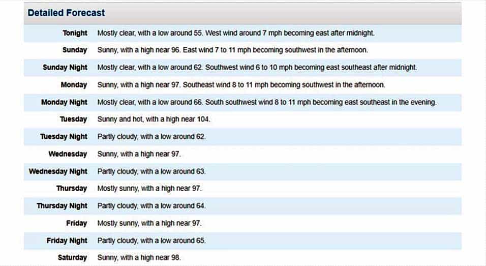
Logan/Cache County
Here’s the Logan/Cache County forecast. To check for updated information, click here.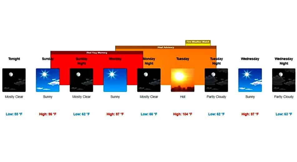
● ● ●
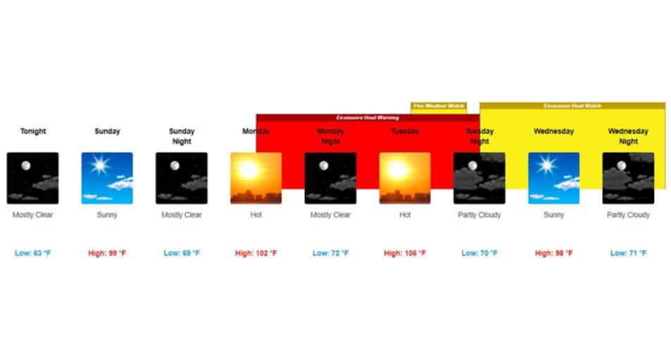
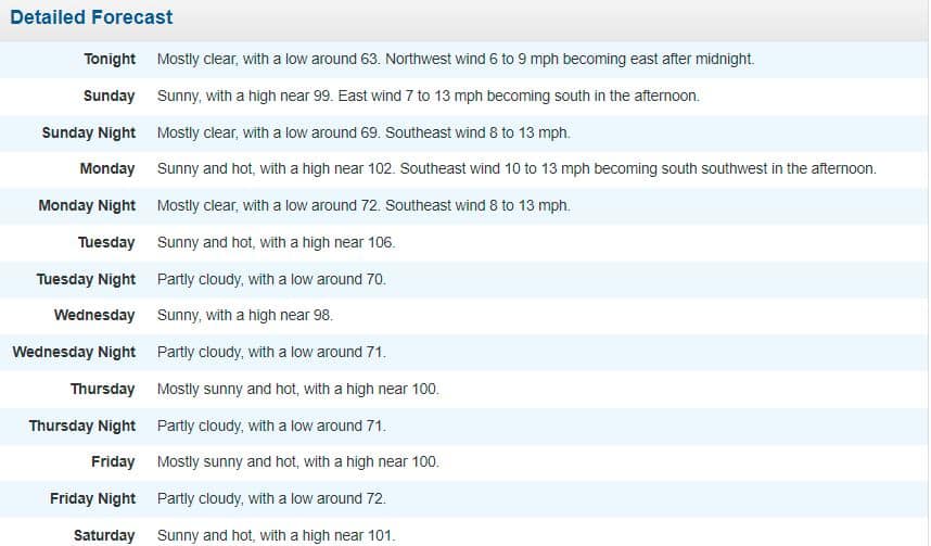
Salt Lake City
Here’s the Salt Lake City area forecast. To check for updated information, click here.
● ● ●
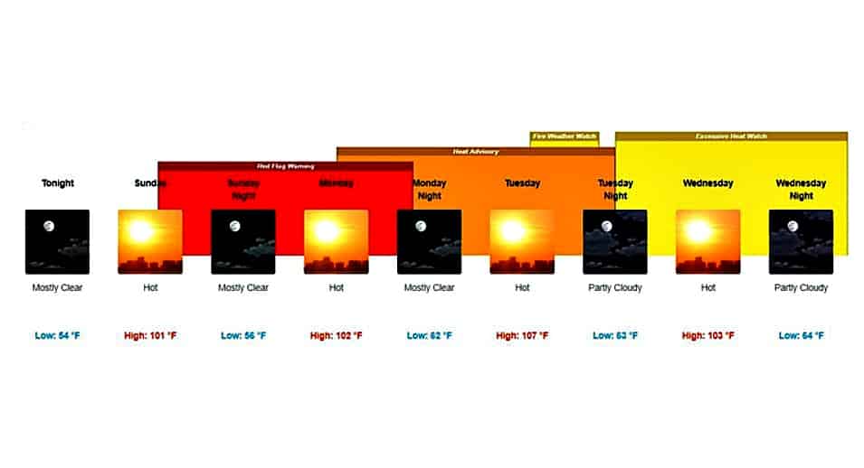
Central Utah
Here’s the Central Utah forecast from Friday afternoon through Monday, based on weather predicted for Richfield. For updates, click here.

● ● ●
Moab/Grand Junction
Here’s the forecast for the Moab/Grand Junction, Colo., area. For updates, click here.

 ● ● ●
● ● ●
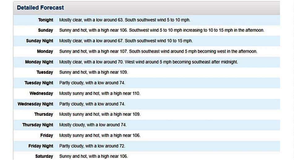
St. George
And here’s the forecast for the St. George area. For updates, click here.
