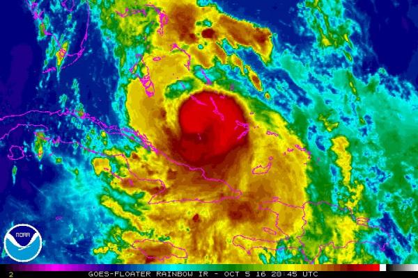
MIAMI, Oct. 5 (UPI) — A very powerful Category 3 Hurricane Matthew moved over the Bahamas Wednesday, regaining strength en route to a closer brush with Florida than predicted earlier in the day.
Residents north of Miami are emptying store shelves and boarding up in preparation what is expected to be a Category 4 hurricane hugging the coast with the eye from about 50 miles off West Palm Beach to virtually overhead at Cape Canaveral between Thursday night and Friday afternoon.
Matthew is expected to make a tight, troubling U-turn into the Atlantic beginning Friday afternoon ending up southbound on Monday.
The National Hurricane Center reported at 5 p.m. that Matthew was about 400 miles southeast of West Palm Beach moving northwest at 12 mph. Maximum winds near the eye were recorded at 120 mph with gusts to 145 mph, with strengthening expected to 130 mph and gusts to 160 mph as it approaches Florida.


