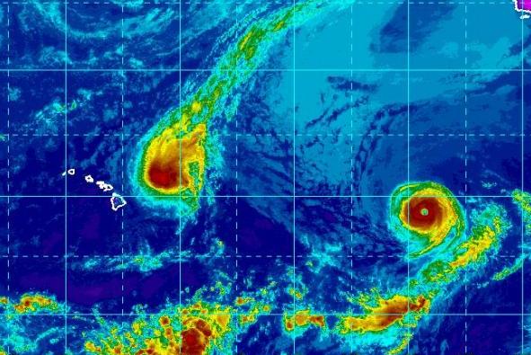
Sept. 7 (UPI) — Hurricane Norman was swirling around the Hawaiian Islands on Thursday and forecasters say its greatest threat right now is high surf — but the next major storm may not be far off.
The eye of the storm was 295 miles east-northeast of Hilo and 450 miles east of Honolulu as of the Central Pacific Hurricane Center’s 11 a.m. HST update. The storm was moving northwest at 9 mph with 110 mph maximum sustained winds.
The Category 2 storm was forecast to pass 200 miles to 300 miles northeast of the Big Island on Thursday and Friday. Surf could rise up to 18 feet on east-facing shores of Hawaii Island and Maui. Surf in Oahu, Molokai and Kauai could rise up to 15 feet.
The Central Pacific Hurricane Center said the high surf is the only hazard affecting land.
“Large swells generated by Norman will continue to build across the Hawaiian Islands through Thursday,” the CPHC said. “Large and potentially dangerous surf is expected along east-facing shores through at least Thursday night.”
No coastal watches or warnings were in effect and forecasters expect Norman to weaken to a tropical storm by Saturday morning.
While it appears Hawaii won’t be hit by Norman, it could find itself in the path of the next named storm — Hurricane Olivia, which is farther east but making its way toward the islands. Forecast tracks show Olivia could approach Hawaii next week.
With 125-mph winds, Olivia has intensified into a Category 3 storm, but forecasters said it should begin to weaken before the weekend.
The eye of the storm was 1,235 miles west of the southern tip of Baja California and was moving west-northwest at 14 mph.


