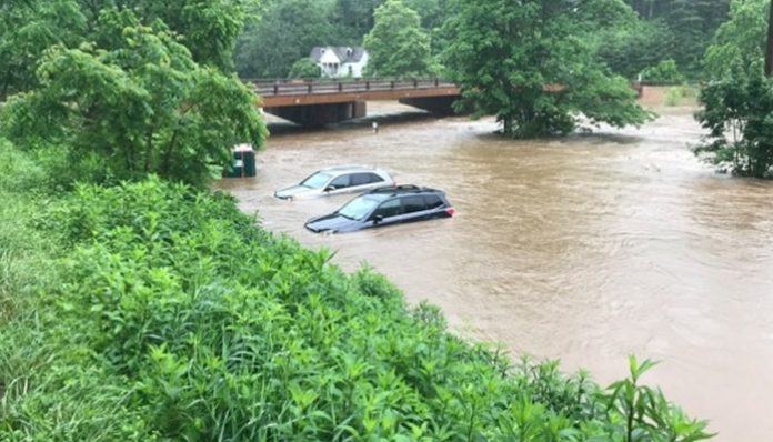
June 9, 2019 (UPI) — More than 12 inches of rain has triggered major flooding in parts of western North Carolina as the southeastern United States faces more flooding downpours into midweek.
Since late last week, a slow-moving storm tapping into tropical moisture has unloaded more than a month’s worth of rain across parts of the Southeast.
For Atlanta, nearly all of the rain that would typically fall each June (3.95 inches) poured down Saturday. The 3.90 inches measured shattered the day’s previous rainfall record of 1.45 inches from 1950.
The deluge led to flash flooding in the city’s southern suburbs. In Jonesboro, runoff from the heavy rain flooded some cars and homes on Saturday afternoon.
Many communities in North Carolina and southern Virginia have also been plagued by road closures due to flooding this weekend.Many communities in North Carolina and southern Virginia have also been plagued by road closures due to flooding this weekend.
Western North Carolina has been hit the hardest by the flooding and heavy rain. A few locations have recorded more than a foot of rain in the past three days. This includes 13.64 inches near Brookford and 13.57 inches east of Boone, N.C.
The deluge has prompted declarations of states of emergency and evacuations.
Residents and motorists will have to remain alert for more flooded roads and poor driving conditions as downpours continue to soak the Southeast through midweek.
Remember never to drive through a flooded road as doing so can put your life and your occupants in danger.
Numerous drenching showers and thunderstorms will continue to stream across areas from Florida to North Carolina, eastern Tennessee and Virginia through Monday. Downpours will also spread into the Northeast, ending the recent welcome dry stretch of weather.
While flooding will not unfold in every community due to how the downpours will be strewed about the region, issues will occur where heavy rain is slow-moving and soaks areas where the ground is already saturated.
By the end of Monday, there can be 15 inches along the eastern slopes of the southern Appalachians and the Piedmont of the Carolinas.
Drier air will finally sweep across the southern Appalachians and into Raleigh and Charlotte, North Carolina, on Tuesday, but that will not mark an end to the downpours in the Southeast.
A piece of the storm affecting the region into Monday will linger into Tuesday and trigger more drenching showers and thunderstorms from Florida to southern Georgia and the coastal Carolinas.
The storm will then spread showers and thunderstorms back across more of the Carolinas and into Virginia at midweek.
“With this storm, the heaviest rain will be farther south and east in the Carolinas, closer to the coast,” according to AccuWeather Senior Meteorologist Dan Pydynowski.
“Showers and thunderstorms can still impact the recently hard-hit areas of the mountains and foothills of western North Carolina,” he added. “With all the recent rain, it would not take much more to cause additional issues with mudslides and rockslides in these areas.”
Even in the absence of flooding, motorists will have to use caution on interstates 10, 16, 20, 40, 77, 85 and 95. Visibility can be reduced and standing water can increase the risk of vehicles hydroplaning at times into midweek.
Despite all the adverse impacts of the unsettled weather, drought relief will continue across the Southeast.
The drought status had risen to moderate and even severe levels from northern Florida to southeastern North Carolina when the U.S. Drought Monitor released its latest update Thursday.
“While some showers and thunderstorms can linger in eastern North Carolina, some drier air will begin to sweep across more of the Southeast on Thursday,” Pydynowski added.
“Finally by Friday, high pressure should build over the entire Southeast and bring dry conditions and plenty of sunshine to the region.”
Much to the dismay of those headed to the attractions at Orlando, the dry air will stop short of pushing showers and thunderstorms out of central and southern Florida later this week.


