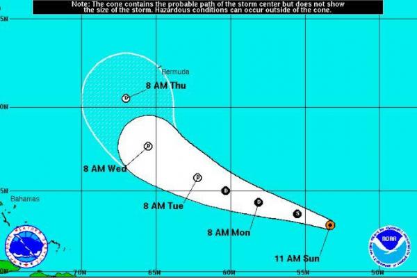
MIAMI, Aug. 21 (UPI) — Tropical Storm Fiona is continuing its northwest trek in the Atlantic as two disturbances have formed, the National Hurricane Center said Sunday.
Fiona was 825 miles east-northeast of the Leeward Islands with maximum sustained gusts of 40 mph and is moving at 15 mph, the center said in its 11 a.m. update. The storm is projected to weaken to a tropical depression by Monday morning as it encounters upper level wind shear during the next day and a half. A storm is listed as a tropical storm when it reaches 39 mph.
A tropical wave was moving off the coast of Africa with a 90 percent chance of developing into a tropical system in the next five days.
“A tropical depression is likely to form during the next couple of days while the system moves westward and then northwestward over the eastern tropical Atlantic Ocean,” the center said in its 8 a.m. outlook.
Another disorganized cluster of showers and storms is about 1,150 miles east of the Lesser Antilles and has a 50 percent chance of developing into a tropical system in the next five days.
“Environmental conditions are forecast to be marginally conducive for development during the next few days, and any development should be slow to occur,” the center said.
After Fiona, the next two hurricane names are Gaston and Hermine.


