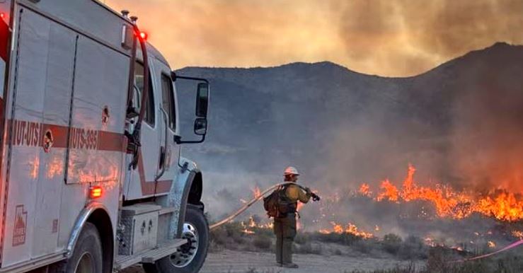
TOOELE COUNTY, Utah, July 19, 2026 (Gephardt Daily) — The Stookey Fire, in Tooele County, has reached 10,337 acres, and is 20% contained.
Personnel assigned to the fire stand at 311.
“Saturday night, crews continued work along the fire’s east and west flanks, widening the containment line to 100 feet,” a Utah Fire Info Sunday update says.
“On the west flank, pockets of grass and juniper have created a mosaic landscape within the fire perimeter. Crews will focus on mopping up around these areas by extinguishing smoldering roots and stumps to contain remaining pockets of heat.
“Mapping flights and ground verification on the west flank are underway to more accurately identify burned pockets, which may result in increased fire acreage. The fire’s south heel remains in monitor and patrol status.”
Resource advisors assigned to the incident are leading fire suppression rehabilitation efforts and are working closely with crews to identify and prioritize areas requiring repair, the statement says.

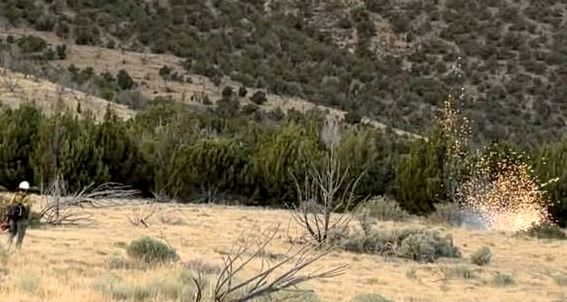
Stookey Fire. Photo: Utah Fire Info
“Weekend recreators, please be mindful of fire equipment and vehicles in the fire area and around Rush Valley and Vernon. As you start planning for Pioneer Day, please remember fireworks are prohibited on all BLM managed lands.”
Sunday will bring monsoonal moisture and cloud cover and a 30% chance of precipitation,” the update says. Temperatures will be in the 80s and winds out of the southeast, 3 to 6 miles per hour, becoming gusty and erratic near thunderstorms.
Traffic closures include Sharp Road, the Pony Express Road between Last Chance Road and Lookout Pass, and Hatch Road between State Route 199 and Pony Express Road.
Evacuations: The Tooele County Emergency Management evacuation zones are still in effect east of the fire. Tooele County Emergency Management uses GenaSys Protect to issue emergency alerts and evacuation maps. To sign up for alerts or access maps, visit https://protect.genasys.com, or download the GenaSys Protect app for iPhone and Android.


Source: Utah Fire Info