SALT LAKE CITY, Utah, Feb. 3, 2021 (Gephardt Daily) — Tuesday may have been spring-like, but more winter is on its way to the Wasatch Front.
The National Weather Service has issued a hazardous weather outlook for the western two thirds of Utah and southwest Wyoming as a cold front moves into the area today.
Snow, heavy at times, will develop across the mountains of northern Utah early Wednesday before spreading into the central and southern mountains during the day, NWS says.
Everyone should be prepared for difficult travel across the mountains of northern and central Utah through Thursday morning.
Precipitation will start out as rain for most valley locations before changing to light snow without much accumulation.
Additional light snow is expected in the mountains of northern Utah on Friday as a weak storm system moves through. Drier conditions will develop for the weekend.
As always, drivers and recreationists are reminded to be prepared for travel delays and possible hazardous conditions.
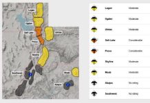
Hikers and skiers are urged to stay out of the backcountry. If you do go into the backcountry, be sure to check the avalanche forecast before heading out. Even if the risk is rated “low,” there is still a level of danger. And remember to take avalanche beacons, avalanche probes, and collapsible shovels.
Information about weather along the Wasatch Front is available at the NWS website.
Information on current road conditions can be found at the UDOT Traffic website.


