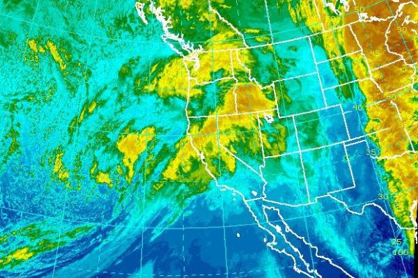
Feb. 21 (UPI) — A new rainstorm in Northern California on Monday is causing concern over rock slides, damaging winds and falling trees.
More than 2 inches of rain fell in some areas of the region between midnight and 6 a.m., the National Weather Service said. It added that 1.5 to 4 inches could fall in lower elevations and up to 10 inches in the coastal hills before the most severe elements of the storm end late Tuesday. The mountainous Sierra Nevada region could see several feet of snow.
Flood warnings continue for all of the Sacramento Valley, with flooding likely due to saturated soil and swollen waterways, the Weather Channel said.
On Monday, wind toppled a large tree in urban San Francisco, and high wind warnings were issued for the entire region. Flooding closed a section of Highway 101, near Redwood City, and a road in the city of Marin was closed for an hour by a mudslide. Sixty flights were canceled at San Francisco International airport by 7 a.m. Water at Anderson Reservoir, already at 100 percent capacity, was diverted through an emergency release pipe. Pacific Ocean waves of up to 10 feet prompted closure of the noted fishing location Pacifica Pier.
The San Joaquin River remained at “danger stage” near the town of Versalis, indicating water is approaching the tops of surrounding levees, said Tim Daly, spokesman for the San Joaquin County Office of Emergency Services.
Water flowing down the spillway of the Oroville Dam, site of an evacuation of nearby residents last week, increased from 55,000 cubic feet per second to 60,000 cubic feet per second in anticipation of Monday’s storm, the California Department of Water Resources said. Officials said they are confident the dam and its spillways can accommodate the water from Monday’s storm.
Lighter rain is possible Wednesday, with drier conditions and occasional light rain expected for the rest of the week, the National Weather Service said.


