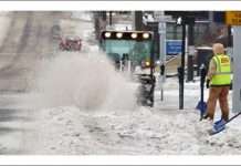
Nov. 15 (UPI) — A rapidly strengthening storm spawned high winds and led to power outages of more than 750,000 customers outages with property damage in the Midwest and northeastern United States and flooding along the shores of the Great Lakes into Monday.
After a new storm formed over the Great Plains on Saturday, AccuWeather meteorologists accurately predicted strong winds would target the Great Lakes and Northeast for the end of the weekend.
By Sunday morning, a broad area of wind gusts ranging between 40 and 50 mph extended from Missouri, Iowa and Wisconsin to Ohio and Kentucky.
By 4:45 p.m. CST, 786,613 customers were without power across Ohio with 336,739, Michigan with 233,259, Pennsylvania with 108,315, New York with 52,030, Indiana with 22,212, West Virginia with 21,239, Kentucky with 8,748 and Illinois with 4,071, according to poweroutage.us.
Across the Great Lakes, winds will reach 50-60 mph in some places, strong enough to not only knock down trees, break large tree limbs and lead to regional power outages but can also cause property damage and lakeshore flooding.
Fierce winds could whip water toward the eastern shorelines of the Great Lakes, causing localized flooding concerns. Places like Buffalo, New York as well as Michigan City, Indiana, and Benton Harbor, Michigan could all expect significant lake-shore flooding through Sunday night.
Airline delays and turbulence could be issues that airline passengers face as the strong winds take aim.
Cold air will be pulled down behind the earlier Sunday rain, allowing for snow showers in parts of Michigan and Wisconsin through Sunday night. Some lake-effect snow squalls are also possible.
In addition to the gusty winds, rain will also be sweeping eastward with this storm through Sunday night.
Gusty winds arriving Sunday afternoon will persist into Monday. Coastal areas of the mid-Atlantic and New England could experience wind gusts between 40 and 50 mph will be common with local gusts to 60 mph prior to the arrival of rain. Travel over high bridges in Philadelphia and New York City could be hazardous, especially for high-profile vehicles such as trucks and trailers.
When the rain arrives, it could come in the form of a squall line, containing wind-whipped rain and a burst of even stronger winds.
Gusty downpours, along with some thunder, will sweep from central Pennsylvania and northern Virginia in the late afternoon to the New England coast Sunday night.
Winds associated with the squall line on Sunday evening will be sudden, strong wind gusts, rather than the more persistent high winds experienced earlier in the day,” said AccuWeather Meteorologist Mary Gilbert.
As the severe weather subsides along the I-95 corridor, precipitation will be changing from rain to snow across the eastern Great Lakes.
Gusty winds will persist, triggering lake-effect snow across the Great Lakes to the central Appalachians spanning Monday night and Tuesday.
The infamous storm that sunk the Edmond Fitzgerald in November 45 years ago was similar in nature to the current wind storm, and is an example of how powerful and dangerous this type of storm can become.


