UTAH, March 8, 2022 (Gephardt Daily) — The National Weather Service has issued a winter storm warning for much of the Wasatch Front, in effect now and continuing through Wednesday night.
The winter storm warning is expected to include heavy snow, with total accumulation to be between 10 and 20 inches, “with locally higher amounts” by the end of the storm, the National Weather Service website says.
The greatest accumulation will be in the mountains.
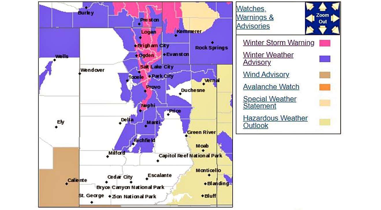
On the chart below, the area of the winter weather warning is depicted in pink.
The snow storm is expected to cause hazardous winter driving conditions across all routes. It is expected to cause problems for drivers during the Tuesday evening and Wednesday morning commute.
“If you must travel, keep an extra flashlight, food, and water in your vehicle in case of an emergency,” the NWS forecast statement says.
A winter weather advisory, depicted on the chart below in purple, is in effect for even more of the state.
The winter weather advisory predicted for the Wasatch Plateau/Book Cliffs, Western Uinta Mountains and Central Mountains, is expected to drop seven to 17 inches of snow in affected areas by the end of the storm. Drivers are asked to slow down and use caution while traveling.

Image: National Weather ServiceThe chart above shows the National Weather Service’s condition map through early Tuesday evening. To see an updated version of the map above, click here.
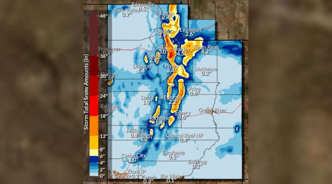
Inches of snow
The chart below shows the NWS projected snow accumulation by Tuesday evening. To see a updated predictions after that, click here. High and low estimations can be found through the same link.


