

UTAH COUNTY, Utah, July 19, 2022 (Gephardt Daily) – A series of fast moving thunderstorms blew across the Wasatch Front on Monday night, generating high winds, heavy downpours and spectacular cloud formations.
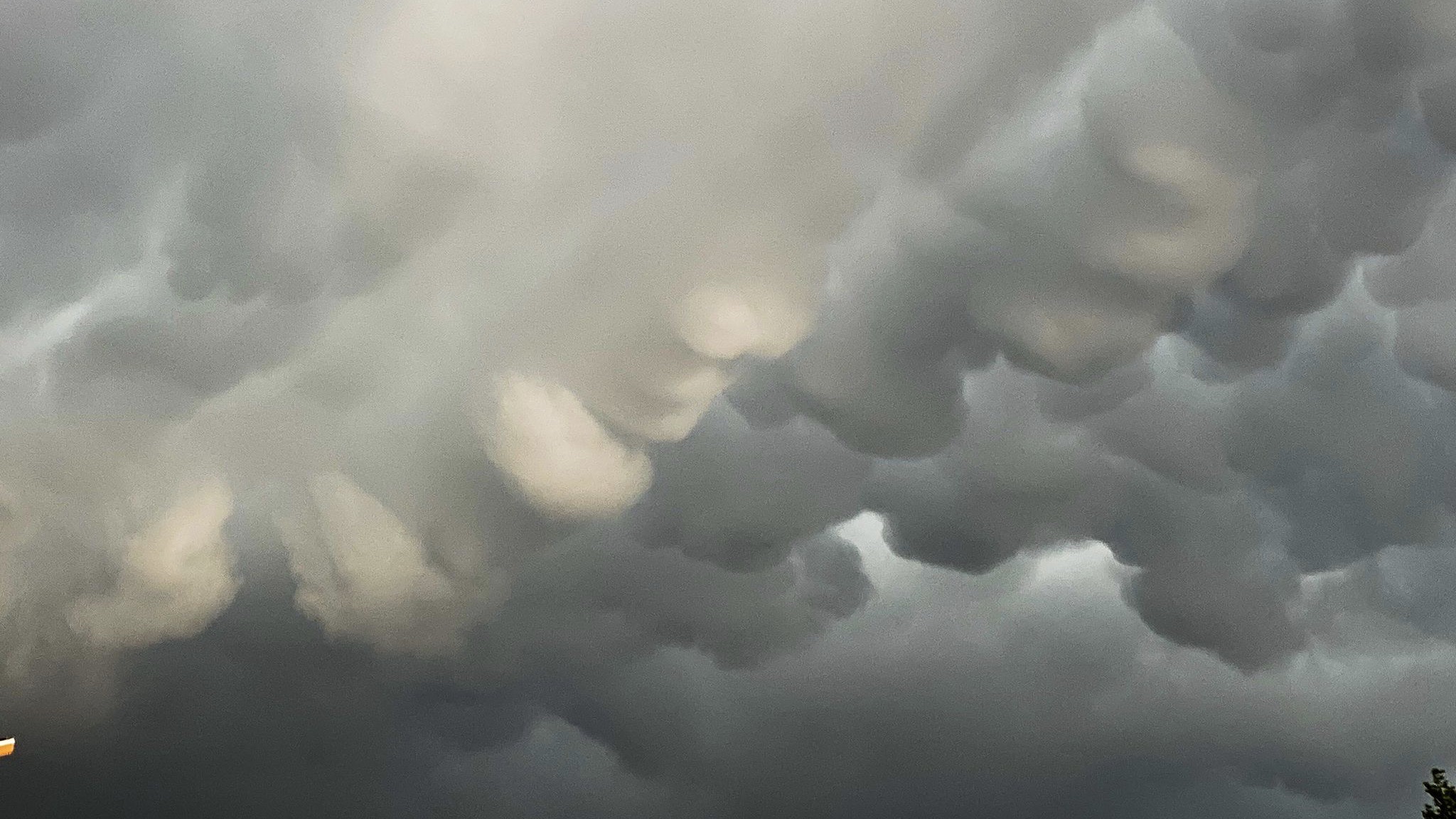
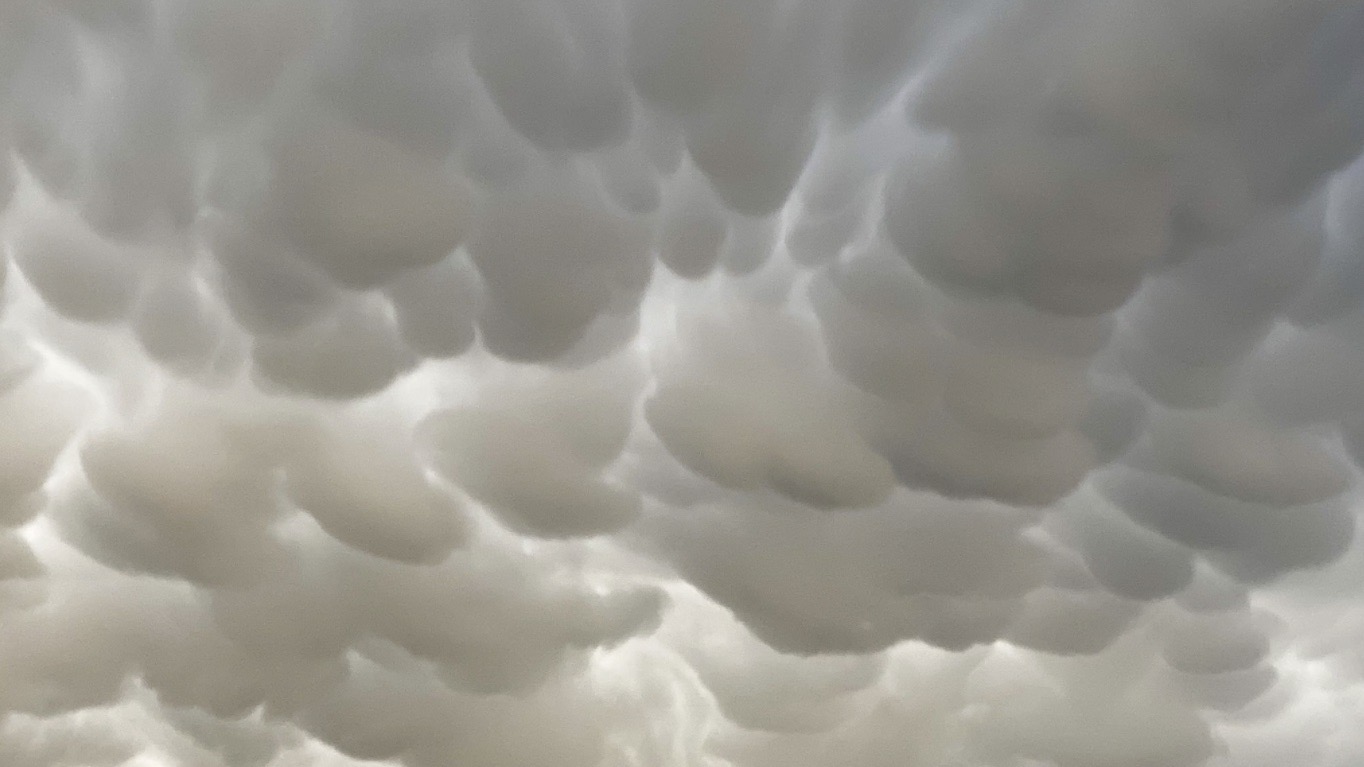
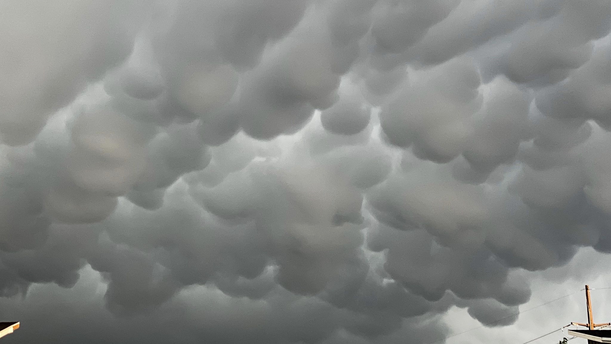
One of the more eye-popping aspects of the unsettled weather was the relatively rare appearance of mammatus clouds.
According to the National Weather Service, mammatus clouds are most often are seen “hanging from the underside of highly unstable cumulonimbus clouds,” those towering anvil-shaped storm cells known for spawning severe thunderstorms and even tornadoes.
Gephardt Daily photojournalist Monico Garza was gearing up for the overnight shift Monday, when he captured mammatus clouds as they made a brief appearance in the skies over Bluffdale.
The National Weather Service in Salt Lake City issued a number of severe weather warnings and advisories across the state starting midday and stretching into the early evening.
The first warnings were issued for the Capitol Reef area where possible flash flooding was forecast for parts of Garfield and Wayne counties.
As monsoonal moisture made its way north, it spawned brief, often violent thunderstorms, with wind gusts of more than 50 mph.
The NWS says more unsettled weather is possible Tuesday, with a continued influx of monsoonal moisture and temperatures once again nearing 100 degrees.
The region is expected to dry out and cool off for the remainder of the week, with daytime high temperatures in the mid to upper 90s.

