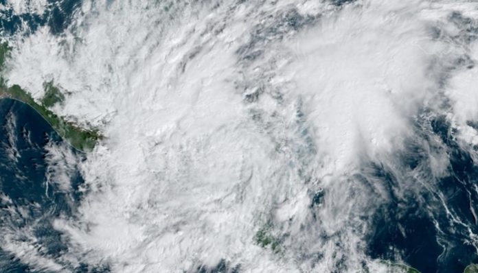
Nov. 6 (UPI) — Tropical Storm Eta has weakened to a tropical depression, but forecasters say it will regain strength once it reaches the Gulf of Mexico and moves toward the southeastern United States.
The storm was a Category 4 hurricane when it arrived in Nicaragua on Wednesday, but weakened as it moved farther over land.
Eta is still producing heavy rain and life-threatening flooding in Honduras, Nicaragua and Belize.
In its 9 p.m. CST update Thursday, the National Hurricane Center said Eta was situated about 85 miles northwest of La Ceiba, Honduras, and 470 miles west-southwest of Grand Cayman. It had maximum sustained winds of 35 mph and was moving north at 8 mph.
Eta would become a tropical storm again once it reaches maximum sustained winds of 39 mph.
From Central America, the storm is expected to strengthen Friday, traveling northeast and chart a wobbly course that will take it over Cuba.
The center of Eta will be situated over the western Caribbean Sea through Friday, and approach the Cayman Islands Saturday and Saturday night, to then arrive over Cuba on Sunday.
Eta could reach hurricane force again on its way toward Cuba and, at this point, AccuWeather meteorologists expect it to approach southern Florida as a tropical storm.
“It appears that Eta will not just wither away over Central America this week as some part of the diminishing storm’s circulation is likely to survive and re-enter the western Caribbean, where the process of reorganizing and restrengthening is bound to occur,” AccuWeather senior meteorologist Mike Doll said.
Florida has largely dodged impacts so far in a record-setting Atlantic hurricane season, which has spawned 28 named systems.
No landfalls have occurred in the state yet this season, but forecasters say the region is not out of the woods. Eta may pose a significant threat to lives and property, and at the very least, an interruption in daily activities and travel late this weekend and early next week.
A tropical storm watch is still in effect for the Cayman Islands, with tropical storm winds arriving within 48 hours, the hurricane center said Thursday.
The water over the northwestern Caribbean is some of the warmest of the entire Atlantic basin and plenty warm enough to nurture a tropical system. Eta is forecast to spend about 36 hours over the warm waters of the northwestern Caribbean, which is enough to allow for strengthening.
Conditions are forecast to deteriorate over western Cuba, especially along the southern coast during Saturday afternoon and evening. Rounds of heavy rain, strong winds and surf are anticipated. The risk of flash flooding will increase, as will the potential for mudslides in the mountainous terrain.
In Havana, on the north side of Cuba, northerly winds are likely to create overwash that could lead to coastal flooding in and around the city.
The storm may have another opportunity to strengthen once it emerges over the Florida Straits to the north of Cuba during the day Sunday. At this time, forecasters expect Eta to approach the Florida Keys and South Florida on Sunday night.
Impacts in South Florida and the Florida Keys late this weekend to early next week will depend on storm’s exact track and speed after its encounter with Cuba. The magnitude of wind, rain and storm surge anticipated in the Sunshine State could change over time as details on Eta’s erratic path and strength become more clear.
Provided that Eta strikes Cuba as a hurricane and maintains some strength while crossing Cuba on Saturday night, a potential exists for hurricane-force wind gusts of 74 mph or greater in part of the Florida Keys and the southern part of the Florida Peninsula on Sunday.
Forecasters said the most likely scenario is for Eta to emerge into the Gulf of Mexico after striking southern Florida, but there is the potential that the storm will linger near Cuba and Florida instead, or it could possibly even move north over the Bahamas.
Eta has made history and matched the strength of the strongest storm of the tumultuous 2020 hurricane season — Hurricane Laura — when its winds peaked at 150 mph earlier this week.
Eta joined the ranks of eight other tropical systems in the Atlantic this season and underwent rapid strengthening, which is defined by a tropical system that experiences an increase its maximum sustained winds by 35 mph within 24 hours.


