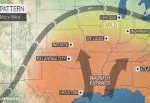
Nov. 9 (UPI) — Winter-like temperatures that pushed into the northern Plains through the middle of this week will continue charging south and east into the weekend.
The first push of cold air arrived in the northern Plains on Wednesday into Wednesday night. Temperatures dropped into the single digits from Montana to the Dakotas and into northern Iowa throughout Wednesday night.
Cold continued to infiltrate the country, spreading through the middle Mississippi River Valley and the Midwest.
The lowest temperatures so far this season are expected for the Northeast and many in the Southeast on Saturday morning, where daily record low temperatures could be challenged for cities from Boston to Nashville.
“The low temperature could plunge to 25 F in Philadelphia on Saturday morning. It hasn’t been this cold so early in the season there since 1976,” Jesse Ferrell, AccuWeather meteorologist and social media manager, said.
A stiff northwesterly wind will keep AccuWeather RealFeel Temperatures as much as 15 degrees F lower than the actual temperature reading across much of the region.
Normal high temperatures for the beginning of November range from the lower 40s F in northern Maine to the lower 60s F in the mid-Atlantic.
The Southeast will not be spared from this push of winterlike air as the chill is expected to penetrate into the Deep South.
Following high temperatures on Friday reading 10 degrees to 20 degrees below normal across the Southeast, temperatures will likely dive down far enough for widespread frost early Saturday morning
Readings for many communities away from the Gulf Coast will fall through the 30s Friday night, with some upper 20s even likely from Arkansas to northern Mississippi and northern Alabama into the Tennessee Valley.
More comfortable air will return to the South for the second half of the weekend and into the beginning of next week.
However, by early next week, a storm is expected to gather in the center of the country, helping to pull down even more cold air across the United States.
In addition to providing more wintry precipitation from places like Texas to Massachusetts, the storm will also bring in an even stronger push of cold.
Over the first couple of days of next week, most communities in the eastern two-thirds of the nation could be at least 10 degrees to 20 degrees below normal for mid-November.
AccuWeather meteorologists are predicting that 147 million people will experience subfreezing AccuWeather RealFeel Temperatures by early next week.
“A widespread killing freeze is likely to end the growing season across much of the South early next week,” said AccuWeather senior meteorologist Dan Kottlowski.
Low temperatures may fall below freezing all the way to the Gulf Coast, but the most intense cold will be in the northern Plains where temperatures may even fall below zero. Coupled with gusty winds, it will feel even colder across the region, and time spent outside will need to be limited.
“While the extreme cold is expected to give way to a milder pattern to close out November, it may take until the third week of November to clear out the well below-normal temperatures from the northern Plains through the Great Lakes,” AccuWeather lead long-range meteorologist Paul Pastelok said.


