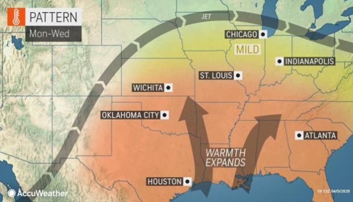
Increasingly mild conditions across the eastern half of the United States will send temperatures rising into midweek.
In the wake of a record-breaking winter storm that tracked through the Plains, temperatures will climb into the 60s in Denver and Rapid City, South Dakota, on Sunday. On Friday, temperatures fell below zero in Rapid City and into the teens around Denver.
Temperatures will also climb into the upper 50s and 60s farther east across the Great Lakes, Ohio Valley and most of the Northeast.
A storm system that brought wet weather and a brisk wind off the Atlantic has finally started to track away from the coast, allowing warmer air to filter in from the west.
Temperatures will climb up into the 60s in New York City and may approach the 70-degree Fahrenheit mark in Washington, D.C., to end the weekend.
The mercury will rise further into the day on Monday as the heat expands across the eastern half of the country. Minneapolis, Chicago and the western suburbs of Boston could all hit 60 degrees.
While showers and thunderstorms will remain sparse across parts of the Midwest and mid-South on Monday, the chance for threatening weather may increase into Tuesday.
A weak atmospheric disturbance is forecast to track along the northern fringes of the warm and humid air through the Plains and into the Midwest, possibly providing enough energy to spark strong thunderstorms.
The exact speed and location of the storm system is yet to be determined, but portions of the Midwest and Ohio Valley, including Madison, Wisconsin, Chicago, Indianapolis and Louisville, Ky., could have heavy showers or thunderstorms Tuesday into Tuesday night.
Into the day on Wednesday, whatever is left of the showers and thunderstorm activity from Tuesday will move toward the East Coast. Although coverage isn’t expected to be widespread, New England to the Southeast could have wet weather.
Another storm system tracking southward from Canada will bring rain to the Midwest on Wednesday. Unlike the previous storm system, cold air will sweep southward in its wake, ushering in crashing temperatures across the central and eastern United States by late in the week.
The warm weather will be short lived in the interior Northeast as some locations may have a return of wintry conditions late in the week.


