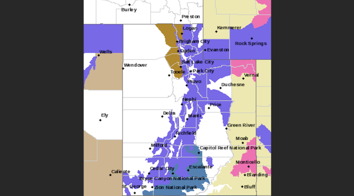
SALT LAKE CITY, Utah, March 13, 2024 (Gephardt Daily) — A late winter storm front moving across the state of Utah Wednesday could pose a challenge for the morning commute and beyond.
According to Utah Department of Transportation mountain snow will impact road conditions in both northern and southern Utah throughout the day, while lake effect snow showers are expected across parts of the “urban corridor” in the north.
“Showers may not be too organized, with most between Farmington/SLC and west to Grantsville, but could be heavy enough for some routes to experience road slush between 5 AM-9 AM,” UDOT said in an early morning post.
“Heavy snow will continue to impact Southern Utah mountains into early Wednesday, including down onto the higher elevation portions of I-15 and desert routes.”
UDOT advised motorists to use caution and TravelWise.
Motorists using canyon and mountain routes should be aware Traction Laws may be enforced, UDOT said.
“The following routes will experience weather-related travel concerns during the forecast period:
- I-80, Grantsville WY border
- I-84, Green Mountain to Echo I-80 Junction
- I-215, entire route
- I-15, Farmington to Lehi; Springville to Santequin; I-70 Junction to Parowan
- I-70, Cove Fort to Sevier; Salina Summit
- US-40, I-80 Jct to Duchesne
- US-6, Spanish Fork Canyon to Price Canyon
- US-189, ID border through Logan Canyon; Sardine canyon; US-6 Jct to Mount Pleasant
- US-191, WY border to north of Vernal; Duchesne to Price over Indian Canyon Summit
- SR-190, entire route
- SR-210, entire route
- SR-158, entire route
- SR-153; Upper canyon/summit
- SR-20; Summit
- SR-143, Upper canyon/summit
- SR14, Upper canyon/summit
- SR-12, Upper canyon/summit


