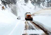
SALT LAKE CITY, Utah, Feb. 22, 2022 (Gephardt Daily) – Utah drivers are being urged to take it slow Tuesday morning, as a series of winter storms have turned roadways into skating rinks, leading to multiple accidents and backing up traffic for miles.
There’s been especially tough-sledding on the I-215 West belt route, as well as I-15, in Utah, Salt Lake and Davis counties, where roads are being impacted by bands of Lake Effect snow and freezing temperatures.
The snowfall is expected to taper off around 9 a.m., but another band of winter weather is predicted to make its way into mostly southern and central Utah later Tuesday evening.
According to a statement posted by the Utah Department of Transportation:
Snow continues across much of the state, less so across far northern Utah, and will continue generally light road snow and ice throughout Tuesday morning.
Snow/ice concerns exist this morning across portions of the Wasatch Front from Centerville and south through Santaquin.
Most roads including I-15 run wet later this morning.
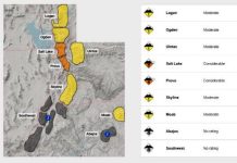
Snow will ramp up later today and tonight, especially across Central and Southern Utah, and bring widespread road snow across the state overnight and through Wednesday.
Heavy road snow should be anticipated across portions of southern Utah, especially over all mountains, Cove Fort/I-70 junction area and southward to Cedar City, and higher portions of I-70. Lower elevation routes including in/around St. George and west near Lake Powell will also see snow with the threat for light road snow/slush late overnight through early Wednesday.
Gephardt Daily will update this developing story as more information becomes available.


