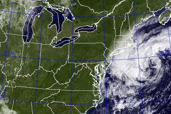
BOSTON, Sept. 5 (UPI) — Though now a post-tropical cyclone, winds and waves generated by Hermine as it sits stalled off the coast of New England could damage Long Island, as well as the coasts of Connecticut, Rhode Island and Massachusetts, forecasters say.
A strong storm surge — yielding dangerous high tides, flooding, high waves, rip currents and beach erosion — is the biggest threat to New England.
“We’re not looking at a landfall,” Dennis Feltgen, spokesperson for the National Hurricane Center, told ABC News on Sunday.
Tropical storm warnings were issued from as far south as Long Island’s Fire Island Inlet to as far north as Sagamore Beach, Mass. Warnings were also in effect Monday on Rhode Island’s Block Island, as well as the Massachusetts islands of Martha’s Vineyard and Nantucket.
As the Weather Channel reported, slow-moving or lingering storms are especially hard to forecast. Meteorologists aren’t clear on whether Hermine will continue to stall and fizzle out, or if it will regain energy and persist.
In addition to high seas, coastal New England will also experience sustained winds of 25 mph with gusts upwards of 45 mph.
The storm winds and waves should begin to subside on Tuesday.


