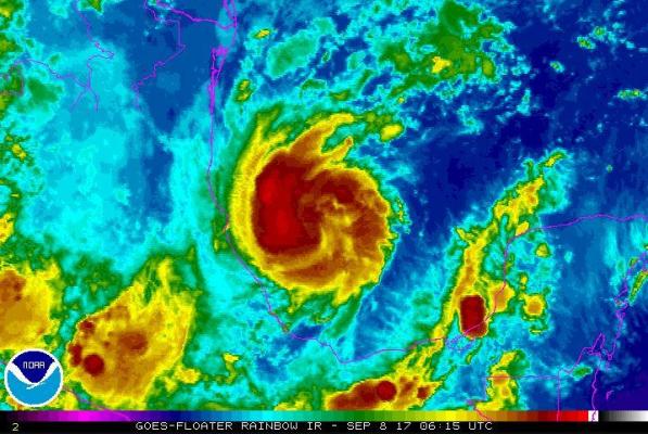
Sept. 8 (UPI) — Forecasters warned that Hurricane Katia could strengthen as it moves toward the coast of Mexico early Friday.
As of its 2 a.m. advisory, the National Hurricane Center said Katia was 180 miles east-southeast of Tampico, Mexico, and 165 miles north-northeast of Veracruz, Mexico.
The Category 1 hurricane’s winds were 85 mph and is moving west at 3 mph.
“Katia is moving toward the west-southwest near 3 mph (6 km/h) and this general motion is expected to continue until the system makes landfall by early Saturday,” the NHC said. “Maximum sustained winds are near 85 mph (140 km/h) with higher gusts. Some strengthening is forecast during the next day or so and Katia could be near major hurricane strength at landfall.”
The government of Mexico issued a hurricane warning for the coast of Mexico from Cabo Rojo to Laguna Verde and a tropical storm warning for Cabo Rojo north to Rio Panuco and south of Laguna Verde to Puerto Veracruz.
Katia is forecast to produce total rain accumulations of 10 to 15 inches over northern Veracruz, and 2 to 5 inches over far southern Tamaulipas, central San Luis Potosi, western Hidalgo, eastern Queretaro, and southern Veracruz through Saturday morning. In isolated parts of northern Veracruz, up to 25 inches of rain is possible.
Katia is the 11th named storm this Atlantic hurricane season and follows both Hurricane Irma and Hurricane Jose — both of which are off to the east in the Atlantic.


