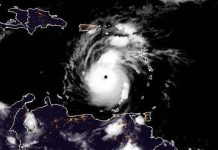
Nov. 12 (UPI) — After making its second landfall in Florida overnight, Tropical Storm Eta began moving offshore, where it’s expected to skirt along the East Coast before heading out to sea.
In its 10 p.m. EST advisory, the National Hurricane Center said the center of the storm was located about 65 miles east-southeast of Charleston, S.C., and was moving northeast at 17 mph. It had maximum sustained winds of 45.
Eta is likely to remain a tropical storm over the next few days as it picks up speed, but could intensify into a non-tropical cyclone over the weekend.
“On the forecast track, Eta is expected to accelerate over the western Atlantic and move parallel to, but offshore of the Carolinas tonight and early Friday before heading well east of the Mid-Atlantic coast by late Friday,” the NHC said in an earlier update.
There were no coastal watches or warnings in place throughout the region.
Eta was expected to bring an additional 1 inch to 3 inches of rain to the Florida peninsula Thursday, with localized flooding in some areas. The storm was also forecast to bring swells along the southeastern coast, including life-threatening surf and rip current conditions.


