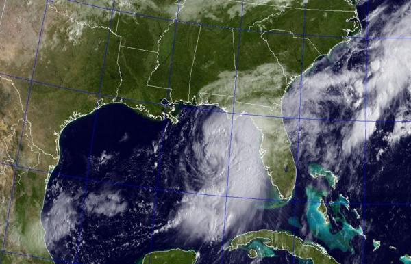
MIAMI, Sept. 1 (UPI) — Tropical Storm Hermine picked up strength in the Gulf of Mexico and may make landfall in northwest Florida as a Category 1 hurricane Thursday.
The storm is expected to dump up to a foot of rain in some areas and bring wind gusts up to 75 mph and localized flooding into Friday. Coastal flood warnings were issued along Florida’s panhandle, from the Suwannee River to Mexico Beach, including the Tallahassee area. Tropical force winds are expected to extend out 140 miles, and up to 20 inches of rain is forecast in some areas.
The National Weather Service issued a hurricane warning for a section of the Florida panhandle coast, including Tallahassee, Perry and Apalachicola.
Much of the coastal southeastern United States could see heavy rain in the coming days.
“The combination of a dangerous storm surge and the tide will cause normally dry areas near the coast to be flooded by rising waters moving inland from the shoreline. There is a danger of life-threatening inundation within the next 36 hours along the gulf coast of Florida from Aripeka to Indian Pass,” the National Hurricane Center said.
The NHC said sustained tropical force winds, up to 55 mph, will slam the coast Thursday afternoon into early Friday. Forecasters said there is a high risk of life-threatening flooding, including flash floods that may necessitate emergency evacuations.
Once the storm hits land, it is expected to weaken over land and move north up the U.S. coast and possibly off shore.
“On Friday and Saturday, Hermine is expected to produce totals of 4 to 8 inches with local amounts of 10 inches possible across portions of eastern Georgia, South Carolina, and eastern North Carolina through Saturday. These rains may cause life-threatening flash flooding,” the NHC said.


