UTAH, Jan 7, 2024 (Gephardt Daily) — If you spent most of your Sunday shoveling walks and driveways relief is at hand, it just depends on where you live.
The National Weather Service says Capitol Reef National Park is expected to get 0.5 inches by 5 p.m while Salt Lake City could get 4.5 inches in the same time period. And there’s one small area of Tooele County could get a crazy 11.9 inches by late afternoon.
What’s next?
So what’s happening after that? The National Weather Service has charts of what it expects through most of this week, and we included those charts below, along with the links to keep for easy updates as the NWS gets updates.
The current predicted high for the first half of the week in the areas we checked include a high of 42 degrees in St. George today, and the low is 7 degrees Wednesday in Richfield. Dress warmly, central Utah.
Below is a state overview as of mid-day Sunday. To check for an update, click here.
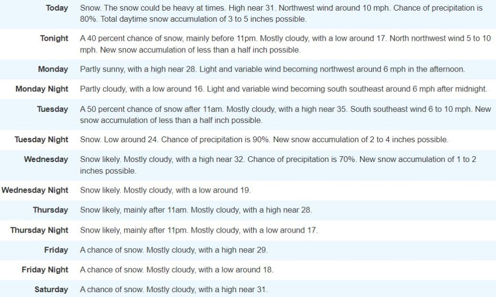
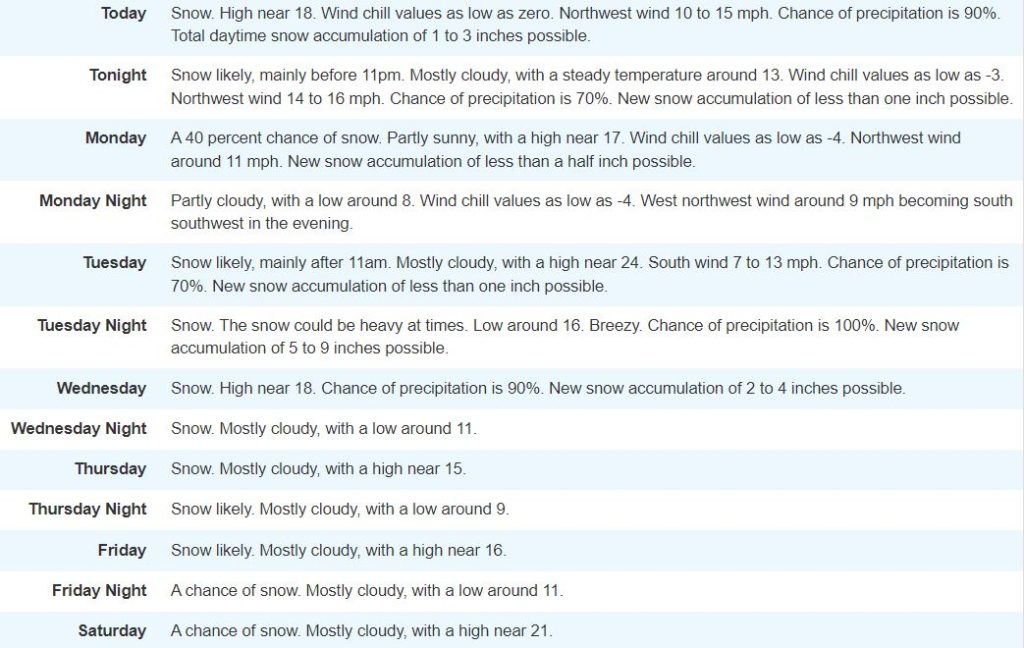
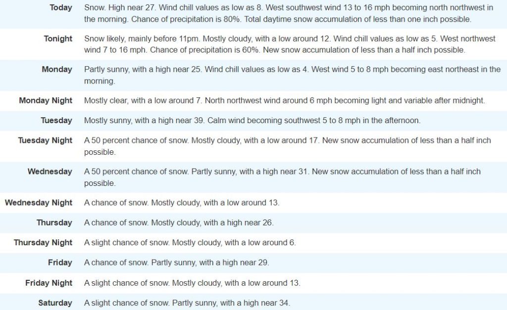
To see what the NWS predicts for your area of the state, see the charts below, and check the links for updates over the coming days. All graphics are from the National Weather Service. The areas included below are displayed from north to south.
Logan
Here’s the forecast for the Logan area. To check for updated information, click here.

Salt Lake City
Here’s the Salt Lake City area forecast. To check for updated information, click here.


Park City
Here’s the forecast for the Park City area. For updated information, click here.


Richfield/Central Utah
Here’s the Central Utah forecast, based on weather predicted for Richfield. For updates, click here.


Moab
Here’s the forecast for the Moab/Grand Junction, Colo., area. For updates, click here.

St. George
Here’s the forecast for the St. George area. To check for updates, click here.


